
Product description
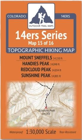
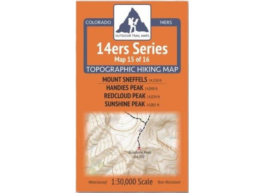
14ers Series Topographic Hiking Map 15 of 16 covers Mount Sneffels on the front side and Handies Peak, Redcloud Peak and Sunshine Peak on the back, including all hiking trails in the surrounding areas. This rugged trail map was designed for on-trail use in the toughest outdoor conditions and includes the following features:
- Waterproof and tear-resistant paper
- Ultralight weight – under an ounce
- Detailed 1:30,000 scale (1 inch ≈ ½ mile)
- Distances for all trail segments
- Compact folded size to fit in your pocket – only 3.8” wide by 6.5” tall
- Convenient size and foldability for quick and easy on-trail review – 19” wide by 13” tall unfolded – no more fumbling with huge maps while on the go
- All fourteener trailheads – not just the popular ones – with GPS coordinates
- GPS coordinates for all key trail junctions
- Route difficulty classes for each peak
- UTM 1000 m grid along with latitude-longitude ticks
- Easy-to-read and intuitive
The front of 14ers Map 15 shows access to Mount Sneffels via Camp Bird Road and Yankee Boy Basin from the east as well as from Blue Lakes Trail over Blue Lakes Pass from the west via Dallas Creek Trailhead to the north. Also featured are the Blain Basin Trail, Mill Creek Trailhead, Sneffels Highline Trail, Mill Creek Trail and Deep Creek Trail.
The Map 15 back shows access to the fourteeners in the Handies Peak Wilderness Study Area and Red Cloud Peak Wilderness Study Area - both managed by the Bureau of Land Management (BLM). Trails to Mount Handies are shown from the west via Sloan Gulch Trail, from the North by American Basin Trail and from the east via Grizzly Gulch Trail. Redcloud Peak and Sunshine Peak area accessed by Silver Creek Trail from the west. Also shown on this map is the Cooper Creek Trail and Cooper Lake area. This is Map 15 of 16 14ers Maps covering all Colorado 14ers.
Recently Viewed
Outdoor Trail Maps
Outdoor Trail Maps 14ers Series Map 15/16 Sneffels | Handies, Redcloud, Sunshine
$5.95
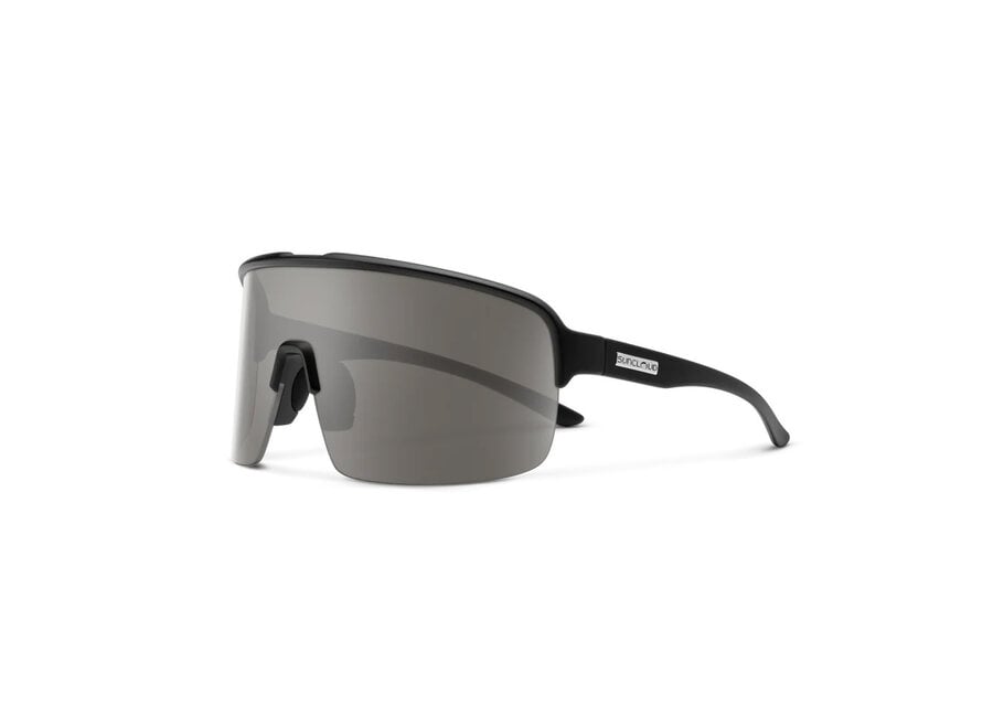
Suncloud Optics
Suncloud Amplify Matte Black Polarized Gray Sunglasses
$79.95
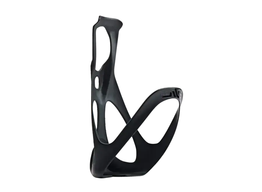
ENVE Composites
ENVE Carbon Bottle Cage
$70.00
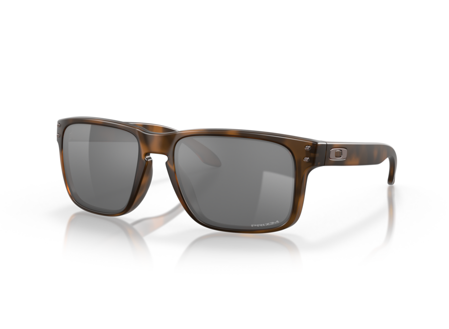
Oakley
Oakley Holbrook Matte Brown Tortoise Prizm Black Lens
$184.00
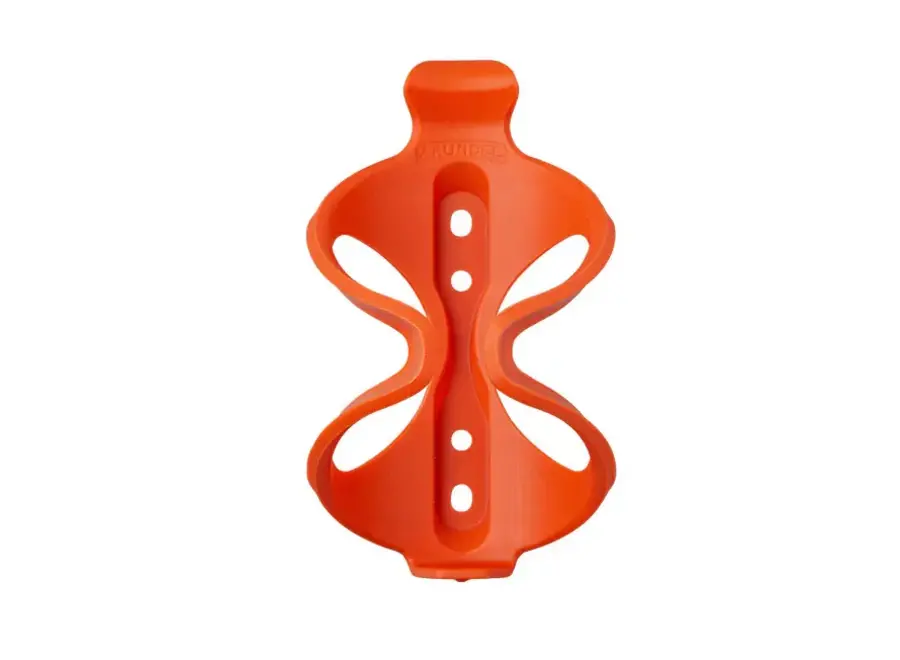
Arundel
Arundel Grypto Bottle Cage Orange
$25.95